Thursday, 12 April 2012

Easter at Mt Feathertop

We had aimed at getting up to Mt Feathertop some time in February but due to some very unfortunate circumstances we weren't able to make it. We made new plans for Easter and were able to be joined by some friends this time.

The day arrived and we started walking in cloud, with the threat of rain and a forecast of thunderstorms. This didn't slow the boys down who took off a a great pace with no sign of slowing down.
Foggy statrt
 We managed to keep pup with the boys for the first hour and met them at a couple of rest breaks before they well and truly left us behind. Of course, I was using the excuse that I needed to stay at the back of the group "just in case" but I think they saw through my excuses.
Break time
 Thankfully the weather didn't close in any further and never developed into the threatening rain. This meant we had quite pleasant walking with plenty of time for photos and  video. I think April particularly enjoyed not having to keep up with the boys and so she made good use of some Mum time.
On the Razorback
 As we approached Federation Hut we could see a few tents already set up but were hoping there wouldn't be huge crowds. Due to the cloud the hut popped up out of nowhere rather than seeing it grow closer for the last hour or so.
Approaching Federation Hut
 The second day (Saturday) couldn't have been a greater contrast. We woke to ice on the tents and cloudless skies after an incredibly windy night. Sunrise promised a great day of exploring.
Mt Buffalo in the morning
 We summited in the morning as all the boys had a full day of exploring ahead of us. The girls summited also then returned to the tent for a restful afternoon.
Summit of Mt Feathertop
We left the summit via the northwest spur along a track that was something less than a very minor goat track. We made our way to the MUMC hut then returned around the side of Mt Feathertop in time for a late lunch.

That evening we made our way up Little Mt Feathertop for a chilly, but fabulous, sunset. Remarkably we had no cloud, no rain and no storms today despite persistent forecasts by the weather bureau. We built a cairn, took some photos then climbed down in the dusk.
Sunset

Twilight

Sunset from Little Mt Feathertop
We walked out on Easter Sunday in much the same conditions we walked in with. What a stunning weekend, with some good friends, and fantastic weather.

Friday, 9 March 2012

The last day of our walk welcomed us with a beautiful crisp morning that promised to be a clear and dry day. As I mentioned previously, because of the rest day we had due to snow we were booked on the ferry that departs Narcissus Hut at about 11:00 am. In order to arrive in time we set off from Bert Nichols Hut at 5:30 - 6:00 am. Yep, an early morning but we wanted to make sure we had plenty of time to finish the 10 km walk with time to rest at Narcissus.
Mount Olympus
This is a beautiful, undulating walk along the edge of button grass plains. Much of the walk is spent looking ahead to Mount Olympus laid out in magnificent panorama.
Mount Olympus
As we were again nearing the more accessible parts of the park, due to the ferry, we noticed an increase in both the amount, and quality, of the boardwalk. One of the highlights of this section is the swing bridge over the Narcissus River. This is strictly a one person at a time bridge that has a remarkable amount of bounce in it. This is amplified by the fact you're carrying roughly 20 kg on your back which has a tendency to upset your balance somewhat.
Last of the Buttongrass plains
Whether it was the coffee waiting for us, the ferry to take us along the lake, or the bed waiting for us in Hobart, we made excellent time this morning and ended up with an hour or more to rest and explore the river and upper reaches of Lake St Clair before the ferry arrived.
Yep, we all made it

Narcissus Hut
We had a few goodbyes to make here, although this wasn't the last we'd see of some of our walking companions as we bumped in to several of them at Salamanca Market in Hobart.
The ferry, what a beautiful sight!

Watching the ferry arrive was a lovely feeling. We knew we'd finished and were very proud of the effort everyone put in, particularly the boys. It was a hard walk for them considering the two days of snow we encountered, and the winds strong enough to blow the boys over. Despite the difficulties we encountered there was immediate agreement that we'd be back. Next time, though, we're going to climb as many mountains as we can, and we're going to take the youngest in our family as well.

The date of the next trip? Hopefully, January 2014. Overland, here we come!!

Check back over the next few days and I'll hopefully have a link to a couple of minutes of video.

Tuesday, 21 February 2012

The Overland Track Day 6 - January 6, 2009

Today we are truly on the downhill run, except there's still one range to cross. Thankfully the track crosses the lowest point of the Du Cane range and not over Castle Crag as shown in the photo. Today would be a beautiful walk through a lot of temperate rainforest and then into drier eucalypt forest.

Du Cane Range

After a short 45 minute walk we came across Du Cane hut. This is one of two original huts still standing (the other being the original Pelion Hut). For this reason it's heritage listed and not appropriate to sleep in although it does have some beautiful campsites around it.  

Du Cane hut was originally known as Windsor Castle and is home to the legendary "Possum Pete". This is an infamous possum of indeterminate, yet extremely old age. He has been considered responsible for opening any and every make of pack, tent, sleeping back, container and sundry other items. He can remove food from the most difficult and well hidden places and has never been able to be caught. Thankfully we didn't see him and our food resources stayed intact.


Du Cane Hut
 We walked past several significant waterfalls today, however considering the climb down to them we didn't head too far off track. We had some restful stops in the mossy, temperate rainforest before starting the climb to the 1070m high Du Cane Gap.
Trackside stop
 Once we reached the top of the Gap we noticed the environment start to dry out and the fauna start to change. After the steady climb to the top we then had a steeper climb down the other side of the range to reach our final nights accommodation, Bert Nichols Hut.
Resting at Du Cane Gap
 There was one last highlight for todays walk before we would reach the hut.  Once we reached the forest floor on the other side of the Gap we spotted the "Bottom Tree". It didn;t get it's name because it's at the bottom of the descent. If you look carefully at the photo you'll work out for yourself why it got it's name.
Yep, it's the "Bottom Tree" (look closely)
 Bert Nichols Hut is a very controversial hut. It was built about six months before we did the walk, and cost over $1,000,000 to build. Much of the cost was due to the fact that the materials all had to be airlifted in. the controversy arose because many trees were cut down to clear the space (you can see the firewood under the hut in the photo) and despite all this expense and tree clearing, it only sleeps as many people as some of the smaller, original huts on the track. Hopefully this isn't the direction that the rest of the huts go when they need replacing.
Looking back at Bert Nichols Hut
We had one final night with the friends we'd made on the track then settled in for a very early night as we needed to be out at the ferry pickup by 11:00 am tomorrow and we really wanted to be able to enjoy the last days walk. The early night meant we could be in the track by 6:00 am giving us 5 hours to reach Narcissus Hut and the ferry.


Tuesday, 7 February 2012

The Overland Track Day 5 - January5, 2009

We made a scraggy looking group
 Today would be the day we cross Pelion Gap which sees a distinct change in the fauna. We would move from an alpine environment to a more temperate region. There's a real contrast as we cross the Gap. The saddest moment is realising it's the last time we'll see Cradle Mountain. This thought brought on a well deserved rest as it's quite a climb up from the plains to Pelion Gap.
Some ran out of energy at the top
 Once we arrived we took some photos while others settled down for a quick nap. Pelion Gap is overlooked by Pelion East on one side and Mt Ossa on the other. We weren't in a position to be climbing either one but enjoyed talking to others who were setting off for the 2-3 hour round trip up Mt Ossa. We found out later that many who climbed today got caught on top in a bit of a rain squall so we were thankful we didn't attempt the climb. All it did was whet our appetite for the return trip.
Some didn't
 The boys' sure enjoyed this part of the day as from here to Kia Ora hut is all down hill. It amazed a lot of other walkers to see the amount of energy they had after the climb up.
In fact some had energy to burn!

The boys at the top of Pelion Gap
 It was great to show the boys some of the original sections of boardwalk that still sit on Pelion Gap. Comparing the new track with the old track makes you feel like you're walking on dual carriage way...but not for long.
The original boardwalk
 The descent from Pelion Gap to Kia Ora Hut is a beautiful descent, not too steep, but incredibly scenic as you look toward Cathedral Mountain and the Du Cane range. Castle Crag on the right of the valley is certainly the most imposing peak in this section so it was quite a relief to realise we would skirt around this peak and not have to climb it.
Descending off Pelion Gap

Ghost tree

Looking toward Cathedral Mountain
As we descended into the valley we left the boardwalk behind and got back onto traditional stone and dirt tracks. While these tracks make for slower going sometimes, as you have to negotiate more obstacles, they definitely make for more interesting walking.

We did notice an interesting phenomenon today. Throughout the walk we had often passed, and been passed, by several of the private guiding companies escorting the "well heeled" walkers along the track. These groups were most obvious because of the small, lightly-laden, day packs they carried. They stayed in private huts, built to a much more luxurious standard, and rarely mixed with the general riff-raff. Today we noticed the guides from these groups would often talk to us, particularly the two boys, as they passed. This is quite possibly a recognition of the hard work, and sustained effort, that is required to be self-supporting during a week long walk.
Kia Ora Hut
We arrived at Kia Ora Hut just as the weather closed in and a light, misty rain started to fall. We settled in, got some hot food into us, then had a lovely night catching with everyones' stories from the days adventures. Tonight was the first time my professional skills were really put to use as a german couple arrived with the bloke complaining of a sore shoulder that he thought he had dislocated earlier. It was back in place so there was nothing to be done for him now but I could give him some advice to follow up on when he finished, and some signs to watch out for in the mean time.

Tuesday, 31 January 2012

The Overland Track Day 4 - January4, 2009

The fourth day dawned with the most spectacular weather we'd seen yet. In two days we were going from frostbite to heat stroke. Maybe not heat stroke, as you can see we were still rugged up, but it was beautiful walking weather. Today was to be the longest day for the week at almost 20 kms from Windemere Hut to New Pelion Hut.
Looking back to Barn Bluff and Cradle Mountain
Our first real break for the day came at the Forth River Gorge lookout. It was only a short side trip but the most spectacular views came from the stop on the track itself where we got our best view of Cradle Mountain and could see all the way to Mount Ossa.
Looking Forward to Mount Ossa and Pelion East

My beautiful wife who gets credit for most of the photos

Our best view of Cradle Mountain

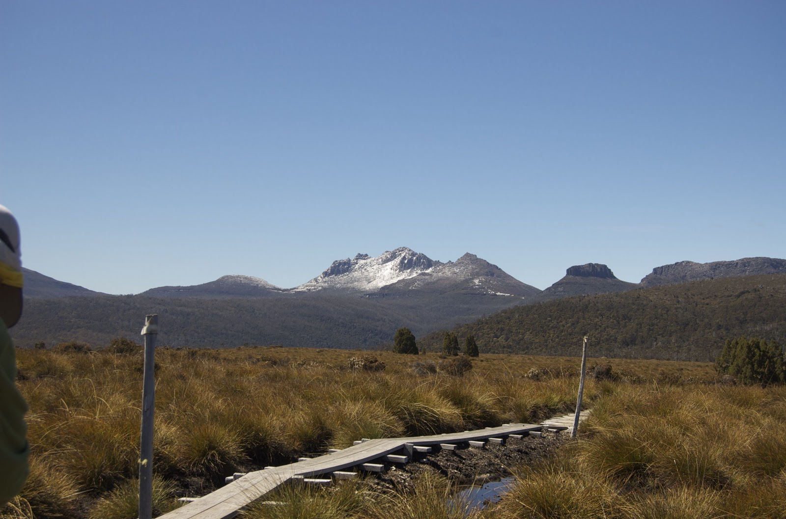
Snow dusted Mount Ossa from Pine Forest Moor
 The walk across Pine Forest was damp at times but quite straightforward with only the occasional creek to cross. The hard section came when we started the descent from Pine Forest Moor to Frog Flats. There's nothing really hard about this section. Lots of mud and tree roots to dodge which in and of itself is not hard. The difficulty lies in the tedium. You walk in a steady descent for many kilometres while knowing the whole time that you will just have to climb the other side of the valley before reaching Pelion Hut for the night.
Resting on the descent to Frog Flats
The saving grace is sitting in front of your tent watching the sun set on Mount Oakleigh. Suddenly the feet don't feel quite so sore and the freeze dried meal tastes so much nicer...okay, I lied about the last bit.
Mount Oakleigh